

New capture starts from what has already been flown. An earlier survey scopes the new work and sets the baseline for change, once it is checked and corrected onto the same frame.
GroundMap Fusion Archive inventories every survey over your site (date, sensor, density, licence, datum), corrects each onto one frame on stable ground and fuses them with new capture into one graded model.
Where it is held
Public LiDAR in Australia, New Zealand and the United States is held by national and state programs, on different terms.
Australia
ELVIS (Elevation and Depth – Foundation Spatial Data) is the national entry point. Developed by participating agencies under the Intergovernmental Committee on Surveying and Mapping (ICSM), it brings together open elevation and bathymetry data from Commonwealth, state and territory governments.
Access still depends on the custodian. NSW Spatial Services point clouds and elevation models download free through ELVIS. Queensland releases LiDAR older than three years free through ELVIS and sells newer data. Victorian LiDAR is under licensed use, with fees set by the coverage purchased. In Western Australia, Landgate supplies LiDAR as extracts on request, quoted per order and under a personal-use licence unless other terms are agreed.
New Zealand
The National Elevation Programme of Toitū Te Whenua Land Information New Zealand (LINZ) provides open LiDAR-based elevation data for most of the country; national LiDAR coverage passed 80 % with the PGF-LiDAR Programme. Elevation models and point clouds are free to download or stream as open data, under Creative Commons Attribution 4.0. Copyright sits with the licensor named for each dataset, which may be a council, a regional council or LINZ itself, and the credit must name it.
United States
The USGS 3D Elevation Program (3DEP) is the elevation component of The National Map. All 3DEP products are free of charge and without use restrictions. Data is specified by quality level: QL2 requires at least 2 pulses per square metre and QL1 at least 8, both with a vertical accuracy (RMSEz) of 10 cm.
Five checks on every earlier survey
A tile on a portal is not yet a dataset you can build on.
- Date
- When it was flown, not when it was published. A survey older than the last earthworks describes a different site.
- Density
- Points per square metre, and how many of them reached the ground. Under canopy, ground density decides what a terrain model can show.
- Specification
- The specification it was flown and classified to, and the accuracy it states: the ICSM specification in Australia, the National Aerial LiDAR Base Specification in New Zealand, the USGS Lidar Base Specification in the United States. Older surveys predate the current versions.
- Licence
- Open, paid or on request, and the attribution it requires; terms differ by custodian, even within one country. GroundMap records each survey’s terms and credits every source.
- Datum
- The reference frame of the coordinates and heights. Australian surveys may be on GDA94 or GDA2020, about 1.8 m apart, with heights on the Australian Height Datum or the newer Australian Vertical Working Surface, which differ by up to about 0.5 m. In New Zealand, NZVD2016 replaced 13 local vertical datums; heights on an older local datum have to be converted. The USGS specification calls for NAD 83 (2011) coordinates and NAVD 88 heights, converted with the GEOID18 model.
What earlier surveys add
Each earlier survey records the ground on the day it was flown. Together they add what a single new capture cannot: history, for change and volumes since the first flight; coverage, where one survey reached ground another missed; and a cross-check, where surveys aligned to one frame agree on height.
They arrive in different datums, densities and specifications, offset from one another in position and height. They have to be aligned before they can be compared or combined.
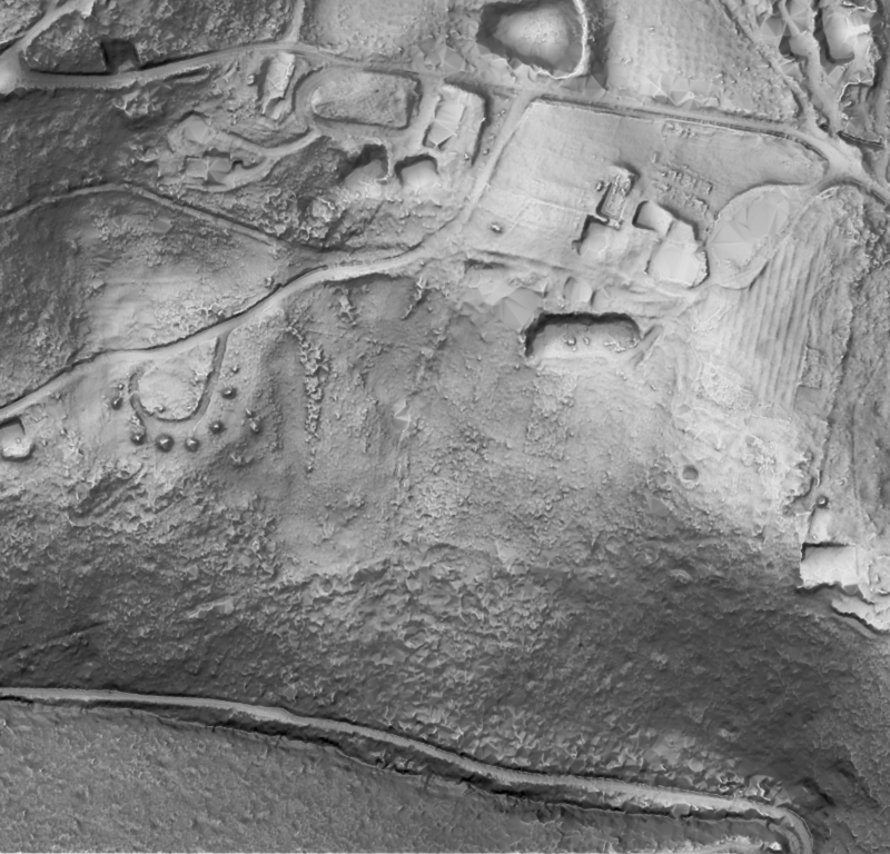
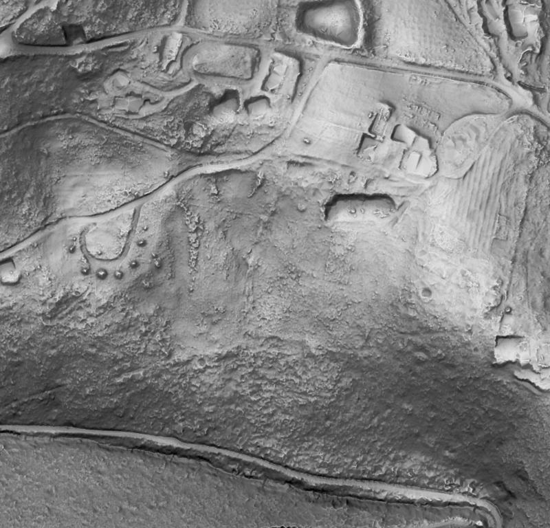
The terrain above fuses four public surveys of the Hobart area, 2011 to 2023/24.
Fusion Archive, scoped to your site.
Sources
- Geoscience Australia. Digital elevation data (ELVIS).
- NSW Government. Elevation and Depth theme.
- Queensland Government spatial support. Elevation and LiDAR.
- Victorian Government metadata. Vicmap Elevation LiDAR Points Collection.
- Landgate, Western Australia. LiDAR (data catalogue).
- ICSM. Australian Airborne LiDAR Acquisition Specification, version 2.0 (2025).
- Toitū Te Whenua LINZ. Elevation data.
- Toitū Te Whenua LINZ. Attributing elevation or aerial imagery data.
- Toitū Te Whenua LINZ. New Zealand Vertical Datum 2016 (NZVD2016).
- USGS. 3D Elevation Program.
- USGS. Topographic data quality levels (QLs).
- USGS. Lidar Base Specification 2025 rev. A: data processing and handling requirements.
- Geoscience Australia. Geocentric Datum of Australia 2020 (GDA2020).
- FrontierSI. Next generation vertical datums for Australia and New Zealand.